


Geophysics Lab
Location: Building E, Room number: E-101
Description about lab:
The Geophysics Laboratory is a cutting-edge research facility equipped with advanced geophysical instruments designed to support a wide range of subsurface exploration, hydrogeological studies, and geotechnical investigations. The lab focuses on non-invasive techniques that allow for accurate and efficient characterization of subsurface features without the need for extensive drilling or excavation. With a strong emphasis on groundwater resource assessment, the lab utilizes state-of-the-art equipment to measure aquifer properties, detect water-bearing formations, and evaluate soil permeability. Additionally, it plays a crucial role in identifying geological structures, faults, and variations in subsurface materials, which are essential for engineering, environmental, and construction projects. By integrating modern technologies such as Surface Nuclear Magnetic Resonance (NMR) and Electrical Resistivity Imaging (ERI), the Geophysics Laboratory provides valuable insights into subsurface conditions, ensuring informed decision-making for industries, researchers, and environmental agencies.
Photos about lab and main equipment:
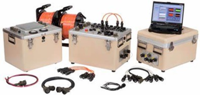
Surface Nuclear Magnetic Resonance 4-channel 24-bit receiver System model Vista ClaraGMR Surface NMR
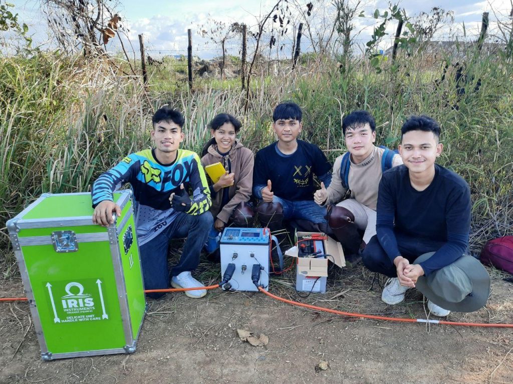
Electrical Resistivity Meter model IRIS SYSCAL PRO Switch 120 (Fieldwork)
Research areas:
- Soil investigation for construction and road
- Groundwater investigation
- Geological structures characterization
- Landfill investigation
- Archaeological and forensic investigations
- Oil and gas exploration
- Minerals and hydrocarbons exploration
Services:
- Groundwater Exploration & Aquifer Characterization
- Identification and assessment of water-bearing formations
- Evaluation of aquifer recharge and storage capacity
- Environmental & Contamination Studies
- Detection of pollutants in soil and groundwater
- Mapping of contamination plumes and remediation planning
- Geotechnical & Engineering Site Investigations
- Assessment of soil stability for construction projects
- Identification of subsurface structures, faults, and voids
- Mineral & Hydrocarbon Exploration
- Subsurface mapping to identify resource deposits
- Structural analysis for mining and oil exploration
- Archaeological & Forensic Investigations
- Detection of buried artifacts and historical structures
- Identification of subsurface anomalies for forensic studies
- Consultation and Technical Support
- Training
- Data interpretation
- Technical reporting